The CGMS statistical toolbox (CST) is a tool to interactively explore the relationship between crop yield predictors and the regional statistics that are supplied from the official statistical administration. The tasks consist of
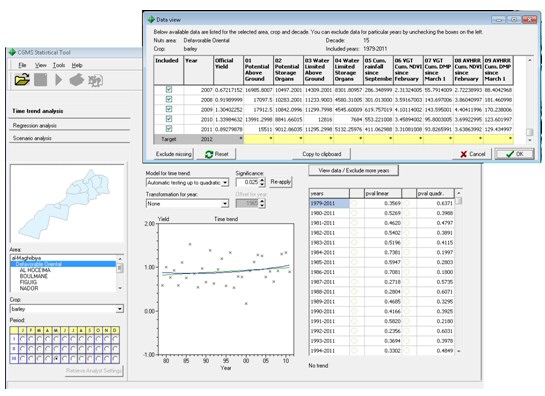
Figure shows the main interface of the CST for the Moroccan pilot region. The screenshot also includes the data window showing that 9 indicators are available which were derived from WOFOST crop growth model simulations (indicators 01-04), sum of rainfall (05) and several satellite-derived indicators from the SPOT-VGT and NOAA-AVHRR satellites (indicators 06-09).
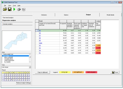
Figure shows the analysis interface for indicator selection showing several indicators that have good correlation with the historic reported yields and which can be used to forecast the crop yield for the current season
Deliverables